skungamaug river mill site, route 74
 Overview of mill site
Waterway: Skungamaug River
Water power: Overshot wheel
Mill type: Grist, saw, fulling, and woolen mills
Water power: Overshot wheel
Mill type: Grist, saw, fulling, and woolen mills
History: – The Skungamaug section of Tolland was one or the more heavily developed mill sites. It is not known how many of the mills operated at one time but a few indicators have provided some pretty good clues. The first saw mill was circa 1722. The first grist mill was circa 1724, a second circa 1750, and a third circa 1800. The fulling mills processing wool and other clothier activity did not emerge until circa 1791. Woolen flannels were produced in the early 1800s.
A number of individuals were involved in establishing mills but without the ability to operate them. They had to recruit millers during the 1700 and 1800s to perform functions such as clothier’s works, dying linen and cotton yarn blue, clothier’s shops, fulling operations, woolen factory as well as saw mills and grist mills. A number of different of different owners and mill operators including Nathaniel and Nathan Flint, Jabez Bradley, Rowland Lathrop, Thomas Fox Samuel Bradley, George Gilbert, Daniel Eaton, Shubael Stearns, Samuel Lamb and a host of others with less involvement with the Skungamaug mill complex. A factory manufacturing woolen goods burned to the ground on September 10, 1838.
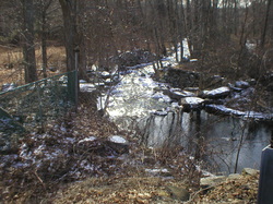
Site Characteristics: concentrated old mill site complex was located just below the current Route 74 bridge location over the Skungamaug River in Skungamaug section of Tolland. A dam was constructed just below the vicinity of the current bridge to support the mills downstream. The old road at the time was somewhat south of the existing road.
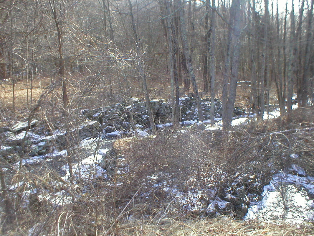
The dam is still functioning but somewhat below its original water elevation. Built of stone, it created a pond of approximately three acres in size. There are remnants at least four mill building foundations remain. Below the dam is a diversion sluiceway that divided into two branches about 100 feet down stream. To the left is a discharge back to the stream and to the right the sluiceway continues another 75 to 100 feet. This supported another mill. A little further down-stream was another pit that could have supported another overshot wheel serving the adjacent gristmill. On the opposite side of the river, west side is an open canal or sluiceway leading to the grist mill and the tail race beyond.
Between the mill buildings foundations and the dam there were at least three water wheel pits, two on the west side of the river and one on the east side of the river in proximity to one another but without indications as to the types of water wheels. Site conditions indicate at least one was clearly an overshot wheel and possibly all were overshot wheels. The site analysis further revealed potentially another water wheel pit on the east side.
Additional Sources of Information: “Lost Mill Sites in Tolland, Connecticut,” 2013, by Richard N. Symonds, Jr.
A number of individuals were involved in establishing mills but without the ability to operate them. They had to recruit millers during the 1700 and 1800s to perform functions such as clothier’s works, dying linen and cotton yarn blue, clothier’s shops, fulling operations, woolen factory as well as saw mills and grist mills. A number of different of different owners and mill operators including Nathaniel and Nathan Flint, Jabez Bradley, Rowland Lathrop, Thomas Fox Samuel Bradley, George Gilbert, Daniel Eaton, Shubael Stearns, Samuel Lamb and a host of others with less involvement with the Skungamaug mill complex. A factory manufacturing woolen goods burned to the ground on September 10, 1838.
Site Characteristics: concentrated old mill site complex was located just below the current Route 74 bridge location over the Skungamaug River in Skungamaug section of Tolland. A dam was constructed just below the vicinity of the current bridge to support the mills downstream. The old road at the time was somewhat south of the existing road.
The dam is still functioning but somewhat below its original water elevation. Built of stone, it created a pond of approximately three acres in size. There are remnants at least four mill building foundations remain. Below the dam is a diversion sluiceway that divided into two branches about 100 feet down stream. To the left is a discharge back to the stream and to the right the sluiceway continues another 75 to 100 feet. This supported another mill. A little further down-stream was another pit that could have supported another overshot wheel serving the adjacent gristmill. On the opposite side of the river, west side is an open canal or sluiceway leading to the grist mill and the tail race beyond.
Between the mill buildings foundations and the dam there were at least three water wheel pits, two on the west side of the river and one on the east side of the river in proximity to one another but without indications as to the types of water wheels. Site conditions indicate at least one was clearly an overshot wheel and possibly all were overshot wheels. The site analysis further revealed potentially another water wheel pit on the east side.
Additional Sources of Information: “Lost Mill Sites in Tolland, Connecticut,” 2013, by Richard N. Symonds, Jr.
Mill site looking down stream
|
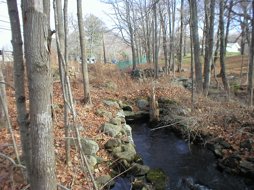
Mill site looking upstream
|
