Lillibridge Mill, Polster Road
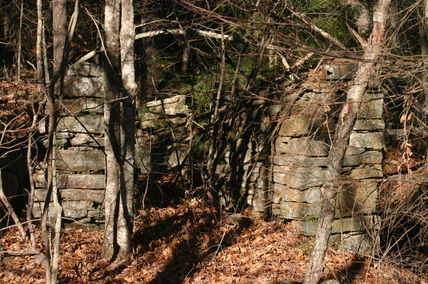
 Mill site looking east to the river
Waterway: Roaring Brook
Water power: Overshot wheel
Mill type: Saw, grist, and shingle mill and spool shop
Water power: Overshot wheel
Mill type: Saw, grist, and shingle mill and spool shop
History: There is limited documented history of Lillibridge mill, its construction, or its operational characteristics. Benjamin Lillibridge constructed a saw mill on the Lillibridge property, circa 1832. Burnham Lillibridge built another mill on the Lillibridge property in 1844. The second mill is thought to be the grist mill. It is not known how long the mill activity operated but it was known to be in operation in 1888.
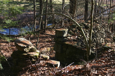
Site Characteristics: Mill site remnants are clearly visible on the west bank of the river with at least two mill buildings and possibly three discernible. The most southerly building was most likely the saw mill. The site is located about 400 feet north of the short east west section of Polster Road where it crosses Roaring Brook. The dam, head race, two tail races, and building remnants are clearly visible today. The dam was about 60 feet long and about eight to nine feet high forming a small pond. A curved dirt and stone dike from the end of the dam served to prevent flooding of a meadow on the east side of the river. A dug 250 foot ditch served as a sluiceway serving two water wheels. The sluiceway or head race received its water supply source from the west side of the dam. At approximately 225 feet the race made a 90 degree split, one serving one mill, most likely the saw mill, and the other serving a second larger mill, most likely the grist mill. The theory for multiple mill buildings is supported by the existence of two separate and distinct tail races as well as building remnants. From the most southerly building was a trail that serviced the mill. It appeared to enter the existing Polster Road right of way a short distance above the bridge crossing Roaring Brook. There is public access to the site as it is owned by the State Department of Energy and Environmental Protection.
Additional Sources of Information: Upcoming book on Willington’s Lost Mill Sites
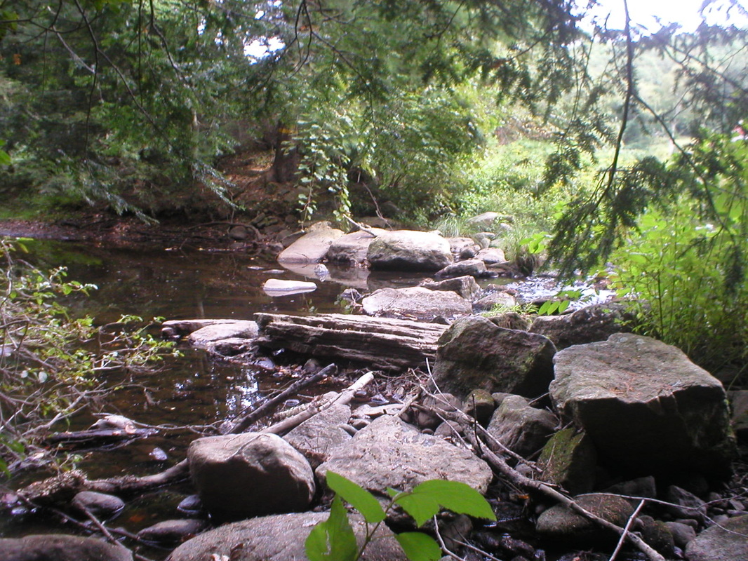
Dam remnants
|
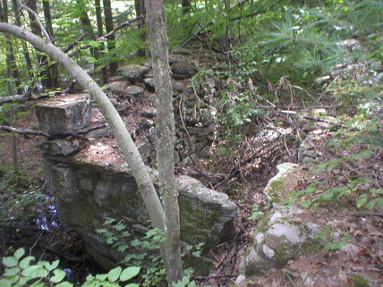
Remnants of downstream mill and wheel pit
|
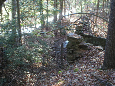
Mill remnant showing mill and tail race
|
Most southerly mill remnants looking north
|
