HUNTINGTON MILL Parker Bridge Road, Coventry
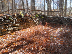 Foundation remnants
Waterway: Rufus Brook
Water Power: Standard Wheel, type unknown
Mill type: Wool hats and a carding operation
Location: Latitude 43 44 28 N and
Longitude 72 19 28 W
Water Power: Standard Wheel, type unknown
Mill type: Wool hats and a carding operation
Location: Latitude 43 44 28 N and
Longitude 72 19 28 W
History – The mill was a circa 1850s mill producing wool hats with a wool carding operation run by Samuel Huntington.
Site Characteristics: The mill was located adjacent to the north side of Parker Bridge Road with the dam located about 350 feet upstream from the road. Some remnants of the dam exist without any other significant features noted.
Additional Sources of Information: A History of Industry Along the Willimantic, Hop, and Skungamaug Rivers in Coventry, CT," by Bill Jobbagy, December 2004.
